On this day we will travel for home but will make a few stops along the way. Our first stop being at Dotsero Volcano. From Wikipedia, Dotsero is a 700-meter (2,300 ft) wide by 400-meter (1,300 ft) deep maar volcano located in Dotsero, Colorado near the junction of the Colorado River and the Eagle River. It is classified as a scoria cone with evaporitic rock, basaltic tephra, and oxidized sandstone. Erupting approximately 4200 years ago, it is the youngest volcano in Colorado.

Once we reach Eagle, CO we will stop at the Rest Stop to get photos of D&RGW Caboose #01461.

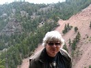
We don’t have plans for any major hikes today but will take a short detour off of I-70 to go up to Shrine Pass to look at the area for a future hike. We noted the “Caution” sign we spotted as we drove up to the pass being something unexpected
 –
–  –
– 
With that, we drive the rest of the way home completing our 1,704 mile romp through Colorado over nine days.
Tags: Caboose, Colorado, Denver and Rio Grande Western, Geology, History, Mine, Mining, MOW, Nature, Photography, Photos, Railfan, Railfanning, Railroad, Train, Trains, Travel, Volcano
As we near the end of our trip, we will spend Day #8 hiking (climbing) up to Hanging Lake near Glenwood Springs, CO. Once parked, I spot a few Fallen Flag Gondola’s that are tough to get photos of but I did manager to get one clear shot.

As you get ready to hike the Hanging Lake Trail there is a Warning Sign. We Saw many on the trail that didn’t read this OR didn’t care!!!

As we walked along the flat section of the trail along the River you get great views of the canyon and places one can also see the Railroad tracks; not a train in sight…

Once you get to the original Hanging Lake Trail Head there is a great sign on the area

Here is another River and Railroad shot I took but still no trains in sight

Once we are deep into the trail, we could see Waterfalls everywhere and this was fall when the water levels are normally low. This is just one of many such places we stop and took photos of…

After a nice long but tough hike we reach Hanging Lake. The last say 0.2 miles is a very steep hike and narrow so mind your footing but the destination is well worth it. We got up to the lake early so there wasn’t too many folks there let but WOW, by the time we left it was packed with people

Found this Hanging Lake Marker on a rock near the lake edge

After getting our shots of the lake we headed farther up the trail to Spouting Rock. It’s not much of a hike by distance but it’s a bit rocky in places so again watch your footing.

By the time we get back down it’s time for Lunch and we find a spot at one of the rest stops in the canyon. I can hear a train coming (finally!) and grabbed the video camera; waiting at this location for the Passing Train. Will share the video later…

Our next stop is the Glenwood Railroad Museum that is in the old depot that is now used by Amtrak. We have been here many a time to only find the museum closed but this time we made sure we would be here when it was open. The front section has an O-Scale/O-Gauge setup and the back section has some nice historic pieces as well as a Large-Scale steam engine
 –
– 
 –
– 
Our last destination for the day is Aspen, CO. We tried and failed to find the old Depot but we have since learned we were looking in the wrong place. We did however find the Colorado Midland Railroad Bridge (39.201200° N 106.849400°W) that today is used for pedestrian crossing over the creek. It’s right next to today’s highway bridge.

Only one more day left of our vacation…
Tags: Bridge, Colorado, Colorado Midland, Denver and Rio Grande Western, Gondola, History, Missouri Pacific, Model Trains, MOW, Museum, National Historic Site, Nature, Photography, Photos, Railfan, Railfanning, Railroad, Speeder, Steam Engine, Train, Trains, Trestle, Union Pacific, Waterfalls
We will head back to Black Canyon of the Gunnison for one more morning hike and given the route we took I spotted a Railroad Bridge at 38.7767N 107.9620W along Hwy 92 ner Austin, CO that was a bit of a different configuration. Time to pull over and get a photograph.

Once back at the North Rim of the Black Canyon of the Gunnison we will take the North Vista Trail to Exclamation Point. We skipped this trail Day #4 as it was late and hot for such a long hike for us We took allot of photos but at Exclamation Point I wish we had taken the hike in the afternoon as I think the light would have been better. Still, it was a wonderful view and hike.
 –
– 
As we head for our next destination for the day, we pull off to view Adobe Hills at 38 37.062N 107 59.740W near Olathe, CO. Nothing like seeing a green farm field right next to an arid landscape and even with the haze of wildfires the light was great to capture the colors and contrasts.

As we head down highway 65 towards Grand Mesa National Forest near Cedaredge, CO we pulled over to get a photos of the Aspen along this hill that were spectacular.

Once inside the Grand Mesa National Forest the number of Aspen that were in full color was amazing and we took advantage of nearly all the pull-offs to take photos.

We will stop for lunch at Grand Mesa Visitor Center and looking South from the picnic table was a nice view towards one of the many lakes up here on the mesa.

While on the Grand Mesa, we take a side trip onto Forest Access Road 100 to “A” Road to Lands End Observatory. The cliff side views are worth the stop and at one stop you can also see “S” Road coming up from below also heading to the Lands End Observatory that sits out on a pointed of the mesa you can see on the first photo below.
 –
– 
We reach Lands End Observatory that is at 39.0252N 108.2242W in hopes of taking some great shots of the valley but the haze of the wildfires was too heavy for any good photographs. We still look some but they are not worth showing. We also took some photos of the Lands End Observatory itself along with the sign talking about this location which at times doubles as a Visitor Center.
 –
– 
While here, we found a friend eating a pile of Sunflower seeds someone left behind. He didn’t seem to concerned about getting his photo taken as long as we didn’t get to close or move to fast. He was bound and determined to eat all the Sunflower seeds that were sitting there.

We then turned around to head back to Highway 65 and then head towards Mesa, CO. The Aspen colors on this side of the mesa were as wonderful as the other side so we also took advantage of nearly all the pull offs.
 –
– 
While on this drive, I spotted a Denver & Rio Grande Western Passenger Car – Scenic Line of the West on private property so I could only get a distant shot from the road but maybe I can get back here and talk to the owner to find out more about this car.

Another full day in and time to head for the hotel…
Tags: Black Canyon of the Gunnison, Bridge, Colorado, Denver and Rio Grande Western, History, Nature, passenger coach, Passenger Train, Photography, Photos, Railfan, Railfanning, Railroad, Train, Trains, Travel, Union Pacific, Wildlife
On this morning, we head out early to hike the Interpretive Trail of the Rabbit Valley Research Natural Area (39.1936° N 109.0201 W) which is about 2 miles east of the Utah-Colorado State-line along I70. Here is the Colorado State description of the area.
Rabbit Valley is located north of the Colorado River along the northwest flank of the Uncompahgre Uplift. The quarry has produced large specimens of several dinosaurs including Camarasaurus, Allosaurus, and Camptosaurus. The Bureau of Land Management and the Museum of Western Colorado have developed the site for interpretive use, and the Museum of Western Colorado directs ongoing fossil digs. The recent discovery of an Iguanodon skull marks the earliest known record of this species. High quality pinion pine – Utah juniper woodlands occur on the site north of the fossil locality.
Please be aware that this site contains features of state-wide significance. Collection is prohibited at all times with out proper permits.
 –
– 
With the morning hike complete we head to Fruita, Colorado to visit the Dinosaur Journey museum which is the Museum of Western Colorado. It’s a nice museum of the dinosaur history of the region and they also had a movie that we also enjoyed. Found this interesting vehicle outside I had to stop and photograph as well.
 –
– 
Across the parking lot at the museum I also spot a railroad passenger car which turned out to be D&RGW #52 and it is sporting the Fruit Belt Route logo on it.
 –
–  –
– 
Our main goal today was to tour the Colorado National Monument again and hope to catch some nice shots under different light conditions. You can tell in some of the shots that wildfire smoke still is in the valley.

Well, you can’t visit here without at least stopping at Balanced Rock as the best angles are not from roadside but a short walk away from the road

We will stop next at the Fruita Canyon Overlook where you can also see Balanced Rock down below

We will only take a short hike on the Canyon Rim Trail this time just to capture a few shots near the visitor center itself.
 –
– 
Independence Monument is the next stop on the drive. This free standing soft red sandstone monument stands 450 feet tall. For those adventurous enough, I believe you can climb this but for us we will enjoy it from the overlook.
 –
– 
Also right in this area is Monument Canyon where other soft red sandstone formations stand tall above the valley floor.

At the Artists Point overlook there is two places to enjoy the views so if you have time and don’t mind a few steps make sure you head to your left to get to the lower section of the overlook to see other views you can’t see from the upper section.

The Fallen Rock overlook is all about this rock slab that has broken away from the cliff wall. Make sure you have a reasonable telephoto lens for this one as it’s a bit of a distance away for many Point-n-Shoot cameras to get a nice shot.

We will briefly get a few shots of Red Canyon as we drive by. Note the notch at the far end of the canyon; the canyon is starting its next phase of change and that will slowly work its way deeper and father back over time.

Cold Shivers Point is one of those places that you can enjoy from the overlook or take a short hike to where this location gets it name. The first photo is the one I took and the second is the one Lisa took of me standing where I took from photo from. Right behind and in front of me is a vertical drop so watch your footing if you head out near the point to take photos.
 –
– 
We will now head back to Grand Junction to visit the Museum of Western Colorado. It was lots of great historical items to enjoy and yes you can go up into the tower as well to get views of the city. You can get to the top via an elevator or use the stairs; below exit into the museum.

For our planned Railfanning, we head over to the Union Pacific Maintenance Department to hopefully get shots of some of the D&RGW equipment that is stored here. We will get a clean shot of D&RGW Crane #028 along with its Wheel / Boom Car. You can see another D&RGW car behind the crane but no way to get a clear shot. I will also take a few shots of some older UP cars that are also stored here.

As we headed back to the hotel we got buzzed my fighters and I wish I had the video camera ready as they passed very low right over our car. The Blue Angels Navy F/A-18 Hornets are in town and on this day they were practicing so once we got to the hotel we had a nice FREE show. Sadly I missed the support plane as by the time we saw it we had put away the camera equipment. Will be interesting to see how well my new HD Video camera caught the action but here is a few of the still photos that Lisa and I took.
 –
–  –
– 

Well, that is it from this day but there is still several more days to go for this trip report…
Tags: Blue Angels, Colorado, Colorado National Monument, Denver and Rio Grande Western, Geology, History, Military, MOW, Museum, Nature, Navy, Passenger Train, Photography, Photos, Railfan, Railfanning, Railroad, Train, Trains, Travel, Union Pacific, Utah, Video, Videos
This day will be all about the Black Canyon of the Gunnison – South Rim. The South Rim is more visited so it takes longer to just do to more people and cars at each stop. We decided to skip “Dragon Point” for various reasons but would make all the other stops.

Our first stop is a bit of a detour and a steep drive down below the Diversion Dam in hopes to get a photo of the dam itself; no luck. Security of today’s climate has the dam fenced off so far up canyon you can only see a small section of it from the fence. Still, the canyon itself made the trip down well worth the drive down.
 –
– 
Next stop is Tomichi Point. As you can see the morning haze and smoke from distant fires makes for an interesting photo. We will stop by here again before the day is out and you will see how the image changes in several hours later in this blog.

Lisa will now start hiking down the Rim Rock Trail towards the visitor center. I will drive down to the visitor center and start hiking the Rim Rock Trail the other way and meet her back at the visitor center.

With Lisa and I both now at the Visitor Center we will head out the back door to the overlook…
 –
– 
Time to drive down to the Pulpit Rock Overlook. Have I mentioned that these stops and trails take you out to rim of the canyon from there is straight down so watch were you step or the next step could be your last.

We will break for lunch and find a picnic table pull out the food we packed in the 4×4. We have now been in the park for three (3) hours and still have allot of stops still to go.
From there we head to Cross Fissures. Lisa and a little me can not help notice the geologic details that add to the beauty of the canyon and the forces that took to carve this canyon.

Our next photo op location is Rock Point where the canyon walls are nearly vertical sheer drops to the floor below.

Off to Devils Overlook next. Again to note, there is little to no railing so yes you can walk right up to the edge and fall quite easy so it best to stay back at least a few feet / yards from the edge when taking photos.

Chasm View is out next stop that is a strongly built platform with walls. So, if you are a bit squeamish with height this is a good place to stop and look outward to enjoy the canyon.

A short drive / walk you reach Painted Wall and yes you will be waking right out to the edge here for the best photos. I did meet a couple that his wife was a bit squeamish with the lack of railings but we were able to get her close enough to see and enjoy the view. The trick was to keep her looking forward and not down and let her set the pace.

Cedar Point is the next stop and a great place to get photos of the Gunnison River below as it continues to carve the canyon deeper and wider.

Farther down the road we reach Sunset View where you can see way up the canyon. You can also see the Cedar Point overlook on the right with it’s well built railings.

We will also spot some of the wildlife that calls this place home. It was amazing how many people didn’t see it or even know what they were looking at. The Turkey Vulture calls this place home and can be seen flying overhead if you look up. Folks were sure grateful we pointed the one out resting on the rocks along the trail to the overlook.
 –
– 
High Point is the end of the road for the South Rim. This photo is looking back up the canyon put right behind me are farm fields. There is also a trail-head here but we won’t take it as the day is nearly gone

I mentioned at the beginning of this blog entry we would stop again at Tomichi Point before leaving the South Rim of the Black Canyon of the Gunnison. Note the difference in haze / light from the either photo taken at nearly the same point / angle hours apart. This is why you can come to a place like this over and over and not see the same thing just because of difference in light.

It’s nearly 3PM and we have now been in the park for seven (7) hours and for us it is time to head back to Grand Junction and have dinner and call it a day. As Lisa says, I always seem to find something railroad related and what do I find in the parking lot at dinner but Union Pacific #43784 High-Railer maintenance truck.

Tags: Black Canyon of the Gunnison, Geology, MOW, Nature, Photography, Photos, Railfan, Railfanning, Railroad, Travel, Union Pacific, Water, Wildlife
It’s a new day and we make an early start to catch the Dillon Pinnacles in the Curecanti National Recreation Area from an overlook on US50 over the Blue Mesa Reservoir. Here the is another sign called the Anatomy of a Mesa talking about this geologic formation.
 –
–  –
– 
The Blue Mesa Reservoir is very large and covered over made historical places including Sapinero, CO. This town was once known as “Soap Creek” when it was formed by the Denver and Rio Grande Western Railroad in 1881. Today only the fish travel its streets below the water.


Our first hike of the day will be the Pine Creek Trail which is a Rail Trail of the D&RGW with the trail head being at 38 27.013N 107 20.715W. The trail starts off with a lot of stairs to get you down from the parking lot on the canyon rim to where the railroad Right-of-Way is above water just below the Blue Mesa Dam spillway
Once down on the Right of Way, it is an easy level walk along the railroad grade. This is also the way to get to the Boat Tour dock (Morrow Point Boat Tours) to tour Morrow Point Reservoir that Lisa and I did several years ago. With the water levels here also down, the grade for the Denver & Rio Grande Western is above water well beyond the dock so we will take advantage of this and hike until the water levels finally get above the roadbed; I would say we got about 1.5 miles into the canyon before the water cut us off.
 –
– 

While down of the D&RGW roadbed, I spotted a Weasel coming up from the water. Only got a few shots before it was gone with this being the clearest shot

Also while on the grade, I would spot a few old Telegraph Polls.

After hiking back up the stairs, we drive over to the Blue Mesa Dam Overlook where you can also see the D&RGW roadbed that we were just hiking below.

A bit farther down the road, we reach a pull-off where we can get a nice view of the Curecanti Needle; which is also part of the D&RGW Railway logo. Good thing we spotted this pull-off as the Overlook area was closed for maintenance. Don’t look down from where we were if you are afraid of heights as you can tell from the photo Lisa took of me it’s straight down!
 –
– 
We will stop next at Hermit’s Rest Trail but only hike a small portion of the trail. The trail will take you all the way down to the shoreline but we just wanted to take a few photographs from higher up.
 –
– 
As we turn get close to Crawfrod, CO, Needle Rock would come into view and though there is a bit of a haze from wildfires it was still worth taking a few shots.

At this point we turned off the highway to head for the less seen Black Canyon of the Gunnison National Park North Rim. Most folks tour this area from the South Rim which we will do on Day #5. On this day (being already late in the day) we will make stops at Chasm View, The Narrows, Balanced Rock, Big Island, Island Peaks, and Kneeling Camel. We will come back to do Explanation Point Day #7
 –
– 
 –
–  –
– 
 –
–  –
– 
 –
–  –
– 
 –
–  –
– 
 –
–  –
– 
 –
–  –
– 
As we head back out of the North Rim, I will stop for a few shots of the Aspen Colors in this area as well.

Time to drive to Grand Junction that we will us as our hotel base-camp for the next few days…
Tags: Black Canyon of the Gunnison, Denver and Rio Grande Western, Geology, History, Narrow Gauge, Nature, Photography, Photos, Railfan, Railfanning, Railroad, Ruin, Ruins, Train, Trains, Travel, Water, Wildlife
On our third day we plan a small morning hike in the Curecanti National Recreation Area at Neversink. The trail was a bit in rough shape from erosion and fallen trees but it was still a nice level hike to get the day started.

Our next stop was at Wilson’s Landing in Curecanti the National Recreation Area. You can kind of tell the water levels are low from the color of the rock that would normally be underwater. The high water line you can see the clearest on the rock on the left side of the photo. The gray color on the bottom half show where the water levels normally get too and you can see that gray color as you scan across the photo to the right.

To really see how low the water levels are is when we stopped at the Dry Creek boat ramp. As you can see on our GPS we should be in the water. The next photo shows our 4×4 at the bottom of the boat ramp sitting in the sand. We have walked down from there to reach the current water levels. Looking over the water you can see the rocks and the line where the water levels are at normally. If you had been watching the news about all the Fires we had out this way because of drought conditions this should give you an idea how little water has falled in recent years
 –
–  –
– 
From there we planned another hike at the Dillon Pinnacles here in the Curecanti National Recreation Area. I took a photo of the sign that explains how this geological formation occurred. The best photos (to me) are from a distance as once you get closer you can see allot of details but cant see the entire structure.


We will stop for lunch at a picnic area in this same area. Somewhere now underwater is a town know as Iola, CO that once was a stop for the railroad. When the dam was built that town, railroad and bridges all went to their watery end. I had hoped with the low water levels maybe something would be visible but no luck. The weather was also turning on us.
 –
–  –
– 
It was the Denver & Rio Grande Western (Lake Fork Spur) that was once here so our next section of this days trip was to travel down the old Right-of-Way from the higher ground into the canyon that is now flooded by the dam. Along the route there are various places to stop as well as information signs. Ruins of the old Railroad Camps use to build the railroad here can still be found. I will also take video while we drove the drivable sections to capture the route.

 –
–  –
– 
Also in this are where various small mines. We spotted one that was gated took a photo through the gate
 –
–  –
– 
We will reach a dead-end soon afterwards and hike the old D&RGW route…


With the low water levels we hiked allot farther then planned because some of the old ROW is currently above water so we could go father then the map said we could. As we got deeper in, dead tree logs that once were floating on the water are now scattered which made the hike more and more difficult. We never did get to a point where the water once again covered to old roadbed of the railroad before we decided to turn back. When hiking these old railroad location don’t forget to look up as often you will spot the old telegraph poles.
 –
–  –
– 
When we stopped by the Visitor Center earlier in the day a Ranger suggested scenic drive that is not commonly taken via Highway 149to see Aspen Colors and wonderful Mountain vistas. He did us good as the drive was wonderful. These photos I took near 38 10.847N / 107 17.396W based on the GPS we had with us.
 –
–  –
– 
Our travel took u also over what was called Soldier Summit (38 10.553 / 107 20.897W)
")
We would also find the Darrel Duncan Memorial Forest (38 15.290N / 107 22.002W) along this ranger suggested route.
")
Well, time to call it a day and head back for the hotel but will see more Aspen Color on our way back too…

Tags: Denver and Rio Grande Western, Geology, History, Memorial, Mine, Mining, Narrow Gauge, Nature, Photography, Photos, Railfan, Railfanning, Railroad, Ruin, Ruins, Train, Trains, Travel, Video, Videos, Water
For our second day of our Fall Vacation we will head back to Marshall Pass, this time in the opposite direction from the past trip. Again, the Aspen Foliage is in it’s full Golden Colors as we make our way through the mountain valleys.

If you recall from my August 18th post (2012 – August Weekend Outing – Part 2) we video recorded Marshall Pass starting from Sargents, CO to US-285, and this trip we will go the other-way to capture the route heading towards Sargents, CO. Reminder, this is D&RGW Right-of-Way ofn the days of Steam Engines and Narrow Gauge trains that we are recording.
 –
– 
As we travel back towards Gunnison, CO where we are staying again for this section of our journeys we pass by a property that had D&RGW MOW Car #04408 to find they have added another addition; D&RGW #5900.

Our next destination is to travel over Ohio Pass and as we start our journey we can see in the distance along with more great fall colors.

As we close in on our primary Denver, South Park, and Pacific Railroad location on Ohio Pass I will stop for another Mountain / Aspen Color shot.

The DSP&P Railway started to build Grade and Track from Gunnison, CO (which they reached in 1882) over Ohio Pass with plans to reach the Pacific Ocean. Construction here ended in 1883 with the grade making over the top of Ohio Pass but track laying never reach there. In building out the grade, the DSP&P had to build “The Great Rock Wall” which still stands today in it partially built along with some Rock Culverts. The hike was a bit to rocky for us to take all the way for this trip but maybe I will get back here another day to photograph more of this section.

 –
– 
 –
– 
While I walked a section of the Big Balloon Loop over the rocky grade, Lisa stayed back and took some great closeup Aspen shots as well as shots of Castle Mountain from this location.
 –
– 
We will drive over Kebler Pass before heading to Lake Irwin to have lunch along the shoreline.

Our final stop on this day will be at the Jokerville Mine Memorial in Crested Butte, CO. On January 24, 1884 a serious mine explosion killed several miners Some of those killed are buried at this location as well.
 –
– 
Lisa will also get some great shots of Crested Butte and the Aspens colors here too…
 –
– 
See, this is why Lisa doesn’t mind doing these historic railroad trips as we do travel through some wonderful areas with lots of geology and vista and being Fall, we also get great Leaf Peeper shots of the Aspens
Tags: Bridge, Denver and Rio Grande Western, Denver South Park and Pacific, Flatcar, Geology, History, Mine, Mining, Narrow Gauge, Nature, Photography, Photos, Railfan, Railfanning, Railroad, Ruin, Ruins, Train, Trains, Travel, Trestle, Video, Videos, Water
On September 15th Lisa and I will take off for a nine (9) day outing that will contain a mixture of allot of the areas we enjoy and enjoy sharing with others such as yourself…
Our first stop is at as anytime we take this route out-of-town in makes for a good stopping point to stretch a bit. This is also a place where many come to Hike/Bike the Colorado Trail and during this time of year it is also a very nice place to take in the Aspen that were turning into the spectacular colors. Here is just one of many photos we would take to give you just a small hint as what the trail was like…

Our next stop will be in Como, Colorado to mainly get photographs of the hotel. A little history might be in order as to how this has a railroad twist and hopefully I have the dates right; if not, I will correct. The Denver, South Park and Pacific reach here in June 1879 and the Roundhouse built in 1881. The Depot was built in 1879 and was later altered into a “L” shape and the depot today is under renovation. The Original hotel (Gilman Depot Hotel) was built here and opened for business January 1, 1881, extended in March 1882, and taken over by Union Pacific in 1885. Sadly in November 1896 that hotel was lost in a fire. Here is an old photo of that hotel that is online at the The Narrow Gauge Circle website (http://www.narrowgauge.org/)

The new “South Park Hotel by the Railroad” (or also known as the “Eating House”) was built in 1897 and still stand today. The DSP&P operated their last train here in April 1937 and the tracks removed a year later. Here is one of the photos we took of this hotel on this day along with the Roundhouse and Depot…
 –
–  –
– 
From here we head down the highway a bit father to Red Hill Pass where some of the old DSP&P route can still be seen. The Aspen colors from here are also wonderful. From here you can also see the “” where the old Denver, South Park and Hilltop Railway once operated that you can read more about in this blog from an earlier entry.

From here we will travel to the Fourmile Travel Management Area into an area known as Castle Gulch to view a rock formation know as The Castles. This will be a Geology (Rock Shot) stop for mainly for Lisa but I do enjoy the geological stops as well; just don’t tell her that…

From here we head into Buena Vista for several stops which will lead us to another place not on our original plans as we didn’t know it was there! Our first planned stop is at the Buena Vista Heritage Museum where the Buena Vista Model Railroad Society was founded in February, 1984 until 2004. Today the model is lightly maintained by the museum and the model is based on the “Denver, South Park and Pacific Railroad,” “Denver, and Rio Grande Railroad” and “Colorado Midland Railroad” during the period of 1900 to 1920.
 –
–  –
– 
We head down the street a few blocks to the last remaining depot in Chaffee County. We have taken photos of this depot before but every-time we were here it was closed. This time we setup our schedule to be here when it was open and it was well worth it. One artifact inside was the old D&RGW Depot’s desk that somehow survived and I also look a photo of a display that showed this depot being saved / moved to the location it is in today.
 –
–  –
– 
Now that we made it into the old DSP&P Depot we turn back to our search of the Colorado Midland Ticket office to get a photo for our records.

A building that was not on list (since it wasn’t RR related) that I spotted I stopped to get a photo since it was also a nice old historic building from times long since gone by and it is a Depot; just a Stage Depot.

Our next structure we locate is the Denver and Rio Grande Western Hospital. This is the second of the D&RGW Hospitals we have now tracked down that the railroad build to take care of their employees healthcare needs.

Our final two planned stops took a bit of research to find as you would not know these were railroad related. Both of these homes today were originally part of the Colorado Midland and were later moved and became private homes. The first is the old Telegraph Office that is also known as the Key Hole house and the other is the Section House. Both were moved to the same neighborhood in Buena Vista and today would just pass as homes and not historic railroad structures.
 –
– 
Now back to the “unplanned” stop; while at the old DSP&P Depot I ask where the old Colorado Midland Depot would have been located since the CM route was on the outside of town well above the town itself and then they would have a stage-coach that passengers from there. This was not as good of a setup as the DSP&P nor the D&RGW but to get the train into town would have been costly for the CM. Well, I got not only the location but told how to drive the old ROW to get to the original site as well as to remnants of a trestle. Time to set up the Video camera to record that section of the grade and take photos!!!! Here is a sample of some of the photos we took…
 –
– 
 –
– 
Well from here we are off to the Christmas 1806 site where Zebulon Pike stopped while surveying the Louisiana Purchase. Not much to see put it’s still nice to stop to overlook where history occurred. The sign itself was placed in 1964 and is still in good shape…

As we head back towards our hotel in Gunnison, we stop for more Aspen GOLD shots as the trees are changing very nicely this year!

Tags: Bridge, Colorado, Colorado Midland, Denver and Rio Grande Western, Denver South Park and Hilltop, Denver South Park and Pacific, Depot, Geology, History, Hospital, Hotel, model railroad club, Model Trains, Museum, Nature, Passenger Train, Photography, Photos, Railfan, Railfanning, Railroad, Roundhouse, Ruin, Ruins, Stagecoach, Train, Trains, Trestle
On September 7th, I took advantage of needing to travel downtown and used my lunch hour to get in some of the local downtown shots I was missing.
My many goal was to get photographs of the “Temporary” Amtrak station in Denver while Union Station is under renovation. They also setup a temporary platform at this location as well.


My next two objectives are old RR structures, one being the old Denver and Salt Lake Depot and the other being the old Union Pacific Warehouse.


With still a little bit of time left before I had to get to my appointment I would track down the old Denver Tramway Power Company Building as well as get photos of a couple pieces of rolling stock; a Santa Fe Caboose and a Trolley which is operated by the Denver Rail Heritage Society
 –
–  –
– 
Tags: Amtrak, Atchison Topeka and Santa Fe, Austria, Caboose, Colorado, Denver and Salt Lake, Denver Tramway, DENVER UNION Station, Depot, History, Passenger Train, Photography, Photos, Railfan, Railfanning, Railroad, Santa Fe, Train, Trains, Travel, Union Pacific